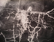
 The White Goddess?: Willow at Langemarck
This was the introduction I wrote for my Topography of Armageddon trench map atlas, in 1991:
When I first read Edmund Blunden's Undertones of War in the early 1960s, I was entranced by his arcadian vision, and intrigued by the obvious difficulty of reconciling the magical and pastoral view of the landscape with the realities of violent and industrialised warfare. A different insight into the same problem was offered by David Jones in his In Parenthesis, and a strange and dramatic, if ghastly, landscape, was also recorded and interpreted by many of the painters of the period, notably Paul and John Nash. The cartographers of the field survey companies provided an altogether more objective, but not unpoetic, map of the same landscape. Many years ago it occurred to me that an atlas of facsimiles of original 1914-18 trench maps might be much appreciated by those interested in the First World War, and I determined to conduct the research necessary to write fairly authoritatively about such maps, and also to build up a collection from which illustrations could be drawn. In 1986 I published my first book, on the Regular Series 1:10,000 trench maps (GSGS 3062), and also began to write articles for journals on the subject of maps and survey in that war.
For the present book I decided to keep the written text to a minimum and concentrate on the visual or graphic elements - the maps themselves. I have endeavoured to give 1:10,000 scale coverage of most of the British sector of the Western Front, in particular the "Old Front Line" of 1914-1916. Of course the 1917 and 1918 battles on this frontage are well represented, but due to limitations of space there is little coverage of the later extensions of the British line down to La Fere. I have used the occasional 1:20,000 scale map to cover areas of lower activity or interest. In some cases of high activity or intense interest I have provided 1:5,000 scale plans, the better to show the intricate trench detail. A few French maps, some used by the British, are included for comparison. The overall selection of maps inevitably reflects my own interests in the development of survey and mapping techniques, but I trust that this will not override my general intention to provide good coverage of the areas in which there seems to be the most interest, particularly the Ypres Salient and the Somme.
The basic topographical survey and map was used as a background for the overprinting of tactical and administrative information, and I have included many examples of these different forms of maps. The most obvious type of tactical overprint is that of the trenches themselves, both British and German. For the years 1915-1917 it was British practice, for security reasons, to show only the German trenches; the British trenches only appeared on "secret" editions, of which very small numbers were printed, mostly for staff use. Most front line troops never saw a secret edition of the sheet covering their front. Thus most of the maps here displayed are the ordinary editions as used by the front soldiers. Print runs for the regular series 1:10,000 sheets ranged from perhaps 3,000 in 1915 to 6-8,000 in 1916-18, and for 1:20,000 sheets were normally 10,000. Other significant overprints were the "hostile battery positions" , "barrage" , "situation" , "target" and "enemy organisation" maps. It was important to show all aspects of the enemy defensive and offensive preparations, so that plans could be worked out, barrages and neutralising fire could be planned, and the tanks and infantry would know the exact position and nature of the enemy dispositions. On a scale as large as 1:10,000, which was the most common for infantry and field artillery, these tactical features, down to individual machine gun and trench mortar emplacements, could be indicated with precision. Techniques were developed for plotting topographical and tactical detail with great accuracy from air photos, and this detail was then transferred to the base map. This map itself was the result of the refinement of survey techniques over the four years of the war, the most important parts of the process being the harmonisation (not seriously undertaken until 1918) of the pre-war trigonometrical systems of France and Belgium by the British survey staff at armies and GHQ, the compilation of cadastral and other large-scale plans onto this trig framework, the plotting of additional detail from air photos, and the development of a reliable system of utilising existing levelling data and depicting ground forms.
I have not attempted to give a campaign history for each sheet, nor do I think this is desirable. There are many published sources for such histories, and most readers will know in advance to which sheets they wish to refer. I have, however, made the occasional comment on actions or battles, but these remarks are in no way definitive. Campaign and battle histories need to be illustrated by maps showing the situation at successive stages of the action, and such quantities of maps and text are too great to contemplate fitting into a general atlas of this sort. For such detailed treatment, readers are referred to the "Official History".
This book is concerned with the land, the landscape, and with people in the landscape. People created the landscape of Belgium and France through thousands of years of intensive cultivation since neolithic times. Clues as to the nature of early society remain in the form of the various lynchets, buttes and other earthworks on the chalk downland, and to a lesser extent in other places. In the twentieth century it remains primarily a rural landscape, studded with many villages, some towns, and fewer cities. The agriculture of the early twentieth century was dominated by human labour and the horse; it was largely unmechanised, particularly so on the small, peasant farms of France and Belgium. The arrival of the opposing armies on this landscape superimposed a new structure of trenches, battery positions and other military works on the pastoral organisation. On the maps, much as a modern motorway cuts its swathe through the countryside, disregarding old field boundaries and ancient roads and trackways, we see these trench systems carving through the land with a wanton disregard for the rural fabric. It was ever thus in war, but the war of l9l4-l8 was on such a scale as to scar the whole country for those years, and for many years after. Not that previous conflicts had not left their mark on the landscape; the many fortified towns and moated farms testified to this, and on the maps the star-shaped ramparts and ditches of Vauban's citadels, themselves often reconstructions of earlier fortifications, stand out as symbols of centuries of conflict in the "cockpit of Europe". Now we see the topographical evidence of the Great War in much the same way - earthworks, mine craters, cemeteries and pill boxes are the archaeological remains which draw the pilgrims and the curious to the Western Front.
Field Fortifications are as old as war itself, and there was little new about the trench systems of 1914-18. The difference between this and previous wars was largely one of scale and technology, and it does not require a massive leap of the imagination to perceive the similarities between, say, Marlborough's sieges in the Low Countries, the stalemate in the trenches of the Crimea, the extensive field-works of the American Civil War, and the shambles of the Somme.
And yet the experience of 1914-18 is peculiarly with us, in the form of the vast quantities of histories, autobiographies, literary and artistic works which were generated by this, the first of the modern wars of whole populations which affected Europe. We feel for the men and women, and for the land, of the Great War as for no previous war. We feel an intimacy with the human experience and with the transformed landscape of the Western Front.
The "Old Front Line" was created in the closing months of 1914. Shallow muddy trenches, at first disconnected, and ragged sandbag breastworks straggled across sodden meadows and plough around Ypres and Armentières, and southwards past Richebourg and Festubert. Rat-gnawed corpses huddled no-man's-land, hung on the rusting wire, slowly dissolved into the stinking mud. The ground changed at Givenchy. South of the La Bassée Canal the clay-covered chalk downland ran past Loos, Notre Dame de Lorette and Vimy Ridge. It continued around Arras to Gommecourt, Beaumont Hamel, the Ancre, Thiepval, La Boisselle and Fricourt to the Somme. These were battlefields like no others before. The pattern was set by the great French attacks of 1915 in Artois and Champagne, and by the German assault on Verdun which started in February 1916. The White Goddess stalked the lunar landscape of Verdun, the Somme, Passchendaele. I am tired and sick of war. Its glory is all moonshine . . . .
I am greatly indebted to many people and institutions for their help, advice and encouragement in my research and publication effort over the past ten years. Chief among these are Peter Clark (Map Research & Library Group, MCE, RE, Royal Geographical Society, and Charles Close Society), Ian Mumford (MRLG, MCE, RE, and CCS) , Francis Herbert (RGS), Yoland Hodson, Tim Nicholson, Roger Hellyer, Richard Oliver (CCS), Peter Scott and Trevor Pidgeon (Western Front Association), David Nash and Colin Bruce (Imperial War Museum), Tony Campbell and Bob MacIntosh (British Library Map Library), Georges Rachaine, Colonel Mike Nolan, the staff of the Public Record Office, Kew, Cambridge University Library, the Royal Engineers Institution Library, the Intelligence Corps Museum, the Royal Artillery Institution and many others to whom I extend my thanks even if I cannot mention them all here. Particular thanks go to Alan Sillitoe, whose strong interest in trench maps echoes my own, for his fascinating and engaging preface, and to Ian Mumford for his erudite note on trench maps in the public domain, which should help to make those maps more accessible to the general public. In conclusion I should like to record my gratitude to the Headmaster and Governors of Brighton College, who in 1990 awarded me a sabbatical term so that I could bring my researches to some sort of completion and prepare some of the material for publication. Like my earlier book on the 1:10,000 Series (GSGS 3062), this volume is more in the nature of an interim offering, and I hope at some date in the future to be able to publish my full History of Field Survey on the Western Front 1914-18. [This was duly published by Mapbooks under the title Artillery’s Astrologers – A History of British Survey and Mapping on the Western Front 1914-1918, in 1999. Both this book, and Topography of Armageddon, are still in print and can be obtained from Naval & Military Press].
1 comment:
Generic Viagra cures me when I don't feel good about some issue I suffer of, however, landscapes also help me to forget about that awful situation I have to face.
Post a Comment