Artillery's Astrologers - A History of British Survey and Mapping on the Western Front 1914-1918
by
Peter Chasseaud
This book, which took Dr Chasseaud over twenty years to research and write, is the definitive operational history of British field survey
organisation, units and personnel on the Western Front. It covers Royal
Engineers and Royal Artillery Survey, and also the aerial photography
for survey and intelligence purposes by the Royal Flying Corps/Royal Air
Force. It examines all aspects of map production for the British
Expeditionary Force, the use of maps, and technological progress in
cartography and artillery survey in 1914-1918. It also includes comparisons with French, German and American military survey and mapping.
It is available from Mapbooks, c/o The Tom Paine Printing Press, 151 High Street, Lewes, East Sussex, BN7 1XU, UK. Price £50 plus £5 post & packing in UK. Please enquire about postal charges to overseas destinations.
The book is a large hardback quarto (A4) format, comprising 558 pages of text and illustrations. It includes coverage of the following :
Pre-war military maps and survey (engineer survey, artillery survey, air survey)
Geographical Section of the General Staff
Ordnance Survey
1st Printing Company RE
The growth of the wartime military mapping and survey organisation on the Western Front
1st Ranging Section RE
1st Ranging & Survey Section RE
Trench Maps, Intelligence Maps, Hostile Battery Maps, etc.
1st Topographical Section
2nd Topographical Section
3rd Topographical Section
1st Field Survey Company/Battalion
2nd Field Survey Company/Battalion
3rd Field Survey Company/Battalion
4th Field Survey Company/Battalion
5th Field Survey Company/Battalion
Depot Field Survey Company/Battalion
Overseas Branch of the Ordnance Survey (OBOS)
Artillery Survey: fixing British battery positions
Indirect fire
Enemy battery location (sound ranging, flash spotting, air photos)
Observation Groups (Flash Spotting)
Sound Ranging Sections; Experimental Sound Ranging Sections; Wind Sections
Calibration Sections
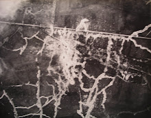
Aerial Photography and Air Survey; Mapping from Aerial Photographs
Compilation Sections (enemy battery location results)
Corps Topographical Sections
Map Printing Technology
The treatment of all the above is primarily in terms of the chronological and operational development of the survey organisation and units, but personnel and scientific developments (e.g. sound ranging theory and apparatus) are also regarded as important.
British survey work in the First World War was mainly carried out by the sappers, though with a significant gunner contribution; this made possible the remarkable British triumphs of Cambrai in 1917 and the Battles of the Hundred Days in 1918. Far-sighted sappers like Winterbotham, and gunners like Tudor and Lecky, understood the principles of war and the necessity of using the latest technology to achieve surprise. They knew that their task was to destroy or neutralise the enemy machine guns and artillery while the infantry and tanks crossed no man's land and captured and consolidated the enmey position, or fought through to exploit success and manoeuvre to threaten the enemy's flanks and rear organisation.