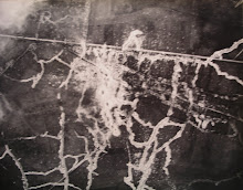

Can anyone identify the town and airfield shown in these two air photos of the First World War period which I've just found in a local flea-market? Look to me like they might be German photos, possibly of a German airfield in northern France or Belgium. Both photos show fiducial marks, which is not normally the case for RFC/RAF photos (though RNAS photos do sometimes show them). The top one is approx. 163 x 217 mm (about 6.5 x 8.5 inches), while the bottom one is approx. 163 x 188 mm (about 6.5 x 7.5 inches).
Added 23 Dec 2010: Ha! I've beaten you to it. I have identified the village and airfield as Abscon, just to the west of Denain (SSW of Valenciennes) in northern France. I thought I'd look at some First World War maps (British 1:40,000 series) to seee if I could spot the street plan with the distinctive feature of the church on the road-bend. I lloked at Sheets 51 and 51A, and sure enough, within a minute or two I found the village of Abscon. Google Earth seemed to confirm it, and when I searched Google images for Abscon I found photos of the church and the Mairie next to it.
So there we are; they're German photos of a German airfield. It now remains to pin down the year. It's clearly the summer, and, given the type of German aeroplanes shown (Steve Suddaby gives his opinion that 'it might be a Hannover CL II or III. It looks to be the size of a two-seater based on comparing it with the wagon and team of oxen/horses pulling it. If my eyes are not deceiving me, it seems to have a double horizontal stabilizer which greatly narrows the number of aircraft types of any country that it might be. The wing configuration seems to match a Hannover. If I'm right about the aircraft type, it would date the photo to late 1917 or later'), may be 1917-1918.
